North Sinai: A Pivotal Region for Gazans and a Historic Conduit of Civilizations
One of Egypt’s governorates, North Sinai, lies in the northern part of the Sinai Peninsula and boasts a unique strategic location as the sole land bridge connecting Asia and Africa. Over the ages, North Sinai has served as a vital commercial route between the East and West, as well as a theater for military operations, a passageway for armies, and a transit point for pilgrim caravans.
After the creation of the State of Israel in 1948, North Sinai took on a critical role in the region, becoming the foremost line of defense against Israeli westward expansionist aspirations. It’s the only gateway for the Gaza Strip to the wider world following the imposing Israeli blockade, seen as a likely destination in an Israeli project for the settlement of Gaza’s population.
Location and Size
North Sinai is positioned in the northeastern part of Egypt, bordered by the Mediterranean Sea to the north. It stretches east along Egypt’s international border with the occupied Palestinian territories and extends from Balawza village in the north to the Mitla Pass in the south, with the southern boundary running from the pass to Ras al-Naqb.
This governorate encompasses the northern half of the Sinai Peninsula, covering an estimated 27.5 thousand square kilometers, which is about 2.8% of the total area of Egypt. It is framed by four governorates: Port Said, Ismailia, and Suez from the west and South Sinai Governorate from the south. Eastward, it shares borders with the Gaza Strip and the Negev Desert in the occupied Palestinian territories.
Terrain
The governorate of North Sinai displays two primary types of natural terrain:
- Coastal Plains: Extending northwards along the Mediterranean, these plains span approximately 220 kilometers in length and range from 20 to 40 kilometers in depth. They consist of flatlands covered by sand dunes, dotted with valleys, springs, and fluvial streams.
- Central Sinai Plateaus: Covering the remainder of the governorate in the central and southern areas are highland regions interspersed with several tall, disjointed mountains, such as Mount Yeleq, rising to 1094 meters, and Mount Halal, ascending to 881 meters above sea level.
Interspersed among these mountainous highlands are several valleys, the largest being Wadi al-Arish, which flows from the south of the governorate to its north, emptying into the Mediterranean at the city of Al-Arish.
Climate
North Sinai’s climate varies with geography; the northern coastal areas enjoy a Mediterranean climate, slowly transitioning to arid and semi-arid as one progresses southward, consequently affecting temperature variations and rainfall levels.
Overall, the climate is warm in winter and hot in summer. Rainfall increases towards the northeastern region, where the annual precipitation averages between 200 and 300 millimeters.

The border of Sinai with the Gaza Strip (Reuters)
Administrative Division
In 1979, Sinai was divided into North and South Sinai governorates. The former comprises six administrative centers: Rafah, Bir al-Abd, Al-Arish, Sheikh Zuweid, Nekhel, and Al-Hasana, encompassing 84 villages and 556 affiliated regions.
Its capital, the city of Al-Arish, is followed by the Bir al-Abd center in terms of area.
Population
As of January 2024, North Sinai’s population stands at 450,531 according to the Central Agency for Public Mobilization and Statistics, representing roughly 0.5% of Egypt’s total population.
The governorate has a low population density, with inhabitants predominantly settling in coastal and urban centers. According to the Ministry of Planning and Economic Development, the inhabited area does not exceed 7.2% of the governorate’s total area.
Importance
North Sinai’s strategic location as the sole land bridge between Asia and Africa underscores its significance as a vibrant center for travel, trade, and land-based military campaigns between the East and West, serving as a crossing for African pilgrims to the Hejaz.
Locally, North Sinai is Egypt’s fortress on the eastern frontier, an essential strategic defense line for the nation’s protection.
The region holds historical and religious significance, having seen numerous civilizations leave behind key historical sites. North Sinai was the crossing of Prophet Abraham, the birthplace of his wife Hagar, and the passageway of Prophets Jacob, Joseph, Moses, Aaron, and the path of Mary with Prophet Jesus upon them all. The region is associated with the wandering of the Israelites, lasting 40 years in the Wilderness of Paran.
North Sinai is also rich in fertile agricultural land and abundant water resources in the northern plains, as well as natural resources like oil, sulfur, gypsum, sodium, and silicon. It boasts a distinctive fishery sector, thanks to the Mediterranean Sea and Lake Bardawil.
Tourism prospects in North Sinai are substantial due to its beaches, warm climate, minimal pollution, and natural desert environments and reserves, attracting desert enthusiasts and birdwatchers.
History
Since prehistoric times, Egyptian rulers recognized North Sinai’s importance as a shield against eastern threats. Pharaohs fortified the area with castles, towers, and military garrisons to secure borders and protect trade routes. When the Pharaohs’ power waned, Eastern peoples, including the Assyrians in the 8th century B.C. and Persians in 525 B.C., invaded Egypt through Sinai.
In 333 B.C., Alexander the Great entered North Sinai, using it as a staging area for his conquest of Egypt. After his death, the Ptolemaic era saw the region used as a thoroughfare for their armies to Palestine and beyond.
The Nabataeans controlled the commercial route through North Sinai in 169 B.C. In 30 B.C., the Romans took over, constructing fortresses along the coastal road to the Levant and establishing a military presence that remained until the Islamic conquest in the era of the Caliph Omar.
Amr ibn al-As entered Rafah in 639 A.D., marking the spread of Islamic rulership throughout Egypt, and during this era, Sinai played a pivotal role as a principal route for Hajj caravans.
Modern History
In 1799, Napoleon Bonaparte’s armies invaded North Sinai, capturing Qatia and Al-Arish, and launching from there to occupy the Levant. In 1800, the Ottomans and the French signed the Treaty of El-Arish for the withdrawal of French forces from Egypt.
Muhammad Ali Pasha assumed Egyptian rule in 1805, with Sinai coming under the supervision of the Egyptian military. In 1882, Britain occupied Egypt, and the Jewish ambitions to create settlements in North Sinai emerged. After Israel’s declaration in 1948, the Egyptian army crossed through Sinai to engage in the Arab-Israeli war, ending in Arab loss.
In the Tripartite Aggression of 1956, Israel, France, and Britain conspired against Egypt, leading to the Israeli occupation of Sinai. Afterward, an international emergency force was deployed, and Israel withdrew.
In 1967, Egyptian President Gamal Abdel Nasser amassed Egyptian forces in Sinai and demanded the withdrawal of the international peacekeepers, leading to the Six-Day War where Israel occupied Sinai, Golan, and West Bank. By 1973, Egyptian forces re-entered Sinai, broke through Israeli defenses, and reclaimed territory leading to the eventual return of Sinai post-Camp David Accords in 1979.
Gateway to the World and Settlement Project
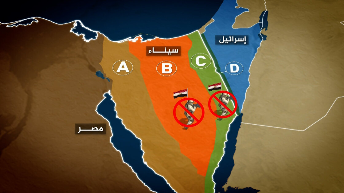
North Sinai has become central concerning developments in Gaza, being the sole escape for Gazans under the strict blockade of 2007. Following the “Aqsa Flood” battle in October 2023 and subsequent Israeli aggression, the Israeli plan to relocate Gazans to North Sinai resurfaced, although the Egyptian authorities remain opposed to forced migration to Sinai.
Economy
North Sinai contributes around 1.8% to Egypt’s national GDP, with oil being its largest sector at approximately 82%. Services account for 5%, manufacturing for 4%, and the remaining 9% is distributed across various sectors including agriculture, fishing, and tourism.
Notable Landmarks
North Sinai hosts key landmarks, including:
- Biluzium Archaeological Area (Pelusium): A significant archaeological site north of Balawza village, featuring remains from the Roman era, including a large theater and fortress.
- Archeological Mounds: Several mounds dating across various historical periods, from Pharaonic to Islamic.
- Al-Arish Fortress: The only remaining structure in Al-Arish, built by Sultan Suleiman the Magnificent in 1560 on ancient Pharaonic ruins.
- Zaranik Nature Reserve: A renowned site for migratory and indigenous birds, it covers about 250 square kilometers, adjacent to Lake Bardawil.